
Search Crown Point Streets
A useful Crown Point street directory search moves from a street address to a stable parcel key, then to records that answer different questions. The assessor identifies the parcel and listed owner. County GIS shows its shape and nearby parcels. The Recorder documents transfers, while library directories may name an occupant or subscriber. Registration status is checked only through the state voter tool with the required personal details. It is not a public search of every voter on a street.
- Enter the number and street in Lake County Assessor Engage. Try direction and suffix variants if the first form misses.
- Copy the Property ID, owner, situs address, mailing address, and legal description. Keep each field under its own label.
- Open the parcel through the Lake County GIS Hub. Check geometry, municipality, township, and linked county services.
- Use the present and prior owners, recording date, legal description, or book and page in the Recorder index. Call or visit when the account gate blocks a field or image.
- For older occupants, ask the library for Haines, Robinson, phone-book, and newspaper sources tied to the same street number.
This sequence keeps ownership separate from occupancy. A deed identifies parties to a transfer, not all people at the site. A directory entry is a dated clue, not proof of current residence. The parcel number is the best handoff when spelling or postal labels vary.
Crown Point Address Search Fields
The Assessor's quick search accepts an owner, address, or parcel number and begins suggesting results after at least three letters. Results display Property ID, Owner Name, Address, City, Map, Detail, and Services. Advanced Search adds ways to narrow the property itself. Those controls help inspect a corridor or building type, but they do not turn assessment data into a household roster.
| Engage control | Input | Useful street task |
|---|---|---|
| Owner, Address or Property Number | Autocomplete text | Find a known address or reuse a parcel key |
| Map Search | Map action | Move from one result to nearby parcels |
| Sale Price and Date | Ranges | Compare transfers along a street |
| Assessed Value | Range | Filter the assessment roll |
| Style, Class, Neighborhood, District | Dropdowns | Separate parcel types and local assessment groups |
| Year Built and Area | Ranges | Compare building eras and sizes |
The result tabs may include Summary, Sketch, Transfer History, Sales List, Valuation, Taxes, Documents, and Street View. Read the portal's as-is notice and confirm legal questions with the proper custodian.
The live Assessor parcel results show how those tabs are arranged.
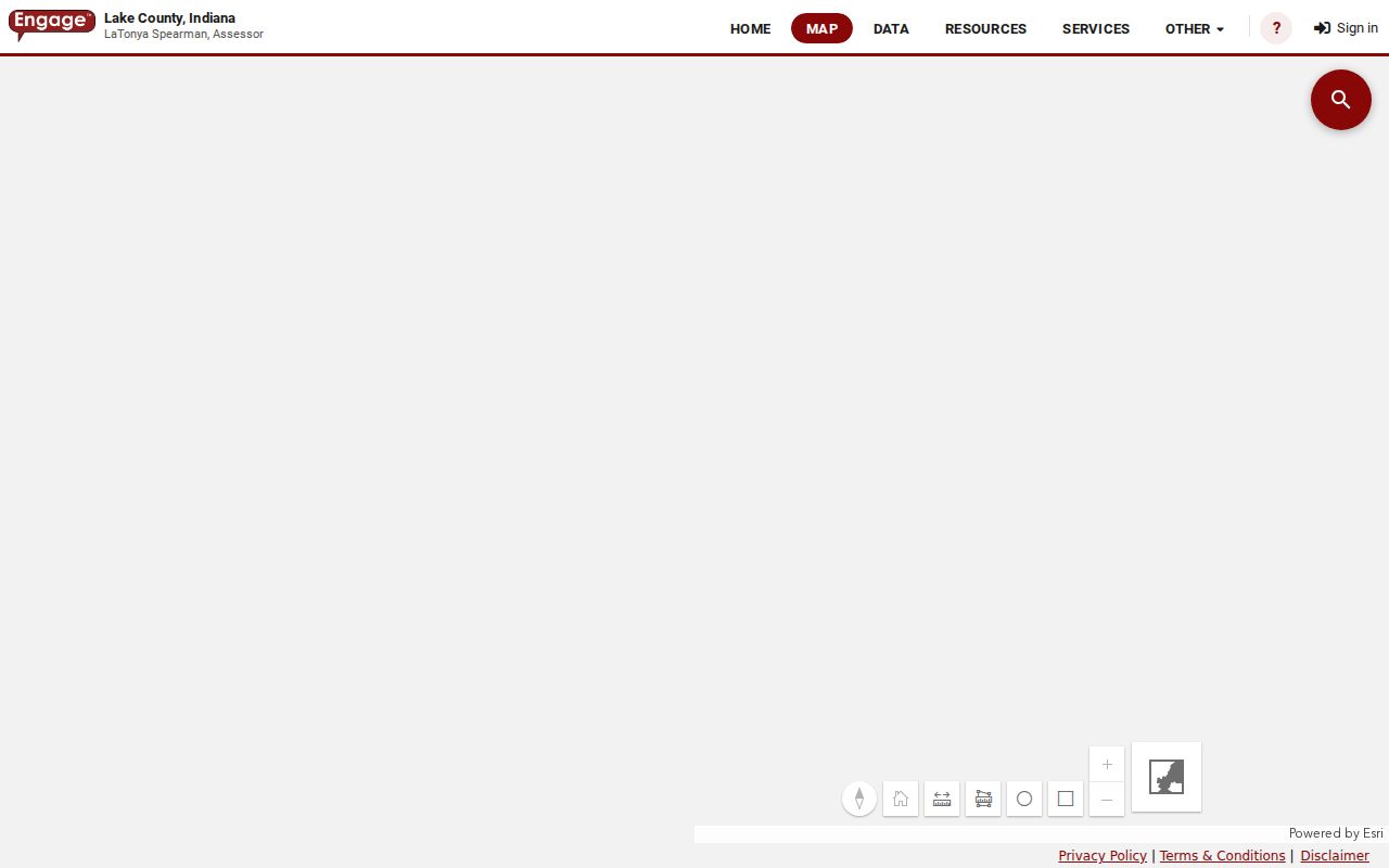
The screen is most useful for collecting a parcel key and opening the detail record before the street search moves to GIS or deeds.
A sample Crown Point parcel detail shows how the selected address opens into the assessor's full property view.
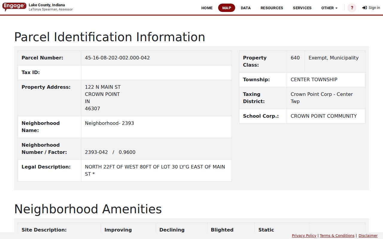
Use the detail view to transcribe the parcel key and labeled address fields. A screenshot is only an orientation aid; the live parcel card remains the record to check for updates.
Crown Point Street Record Coverage
Address-keyed Crown Point records cover parcels, recorded land papers, taxes, construction, maps, and selected historical occupants. Access is split among county offices, city departments, and the library. The table shows what each source can establish and where its limits begin.
| Record Set | Keeper | What It Shows | Access |
|---|---|---|---|
| Assessment roll | Lake County Assessor | Owner, parcel, situs, mailing, class, value, transfers | Free Engage portal; phone or counter |
| Parcel map | Lake County GIS | Boundary, owner fields, legal description, township, links | Free map, query, and export; not a survey |
| Deeds, liens, and plats | Lake County Recorder | Parties, instrument, recording date, book/page, land identity | Account search; paid images; counter, phone, mail |
| Tax record | Lake County Treasurer | Bill, payment, deduction, delinquency, tax-sale trail | Online route; office fallback |
| Permits and code files | Crown Point Building and Code Enforcement | Project address, applicant, work, inspection, case dates | Account portal or specific public-record request |
| Reverse directory | Crown Point Library | Dated address-to-occupant or subscriber clue | Physical volumes and desk help |
The parcel ID and legal description bind the first five sources better than a name alone. The street number links the physical record to library volumes. For registration status, Indiana Voters requires first name, last name, date of birth, and county; it has no open address or ZIP search.
Read Crown Point Parcel Identity
One property can carry several addresses or place labels at once. The sample Crown Point parcel at 122 N Main has a physical ZIP of 46307, while the listed owner mail goes to a post office box in 46308. Copying the mail field into a resident entry would create a false street result. Save the physical, mailing, legal, postal, township, and municipal values separately.
- Parcel
- A mapped unit of land with its own county Property ID.
- Situs address
- The physical location used by assessment, GIS, permit, and code records.
- Plat
- A recorded map that lays out lots, blocks, streets, and other land features.
- Criss-cross directory
- A printed directory arranged by address, allowing a street number to lead to a listed occupant.
A legal description can survive a postal label or street-name change. No official Crown Point-wide renumbering project with a firm year was found, so an unexplained mismatch should be checked against plats, deeds, maps, and the parcel ID rather than assigned to a guessed renumbering event.
Walk a Crown Point Street Map
The county parcel service exposes geometry plus PARCELID, situs, mailing, owner, legal, tax district, township, and links to county systems. Click parcels in sequence to inspect a block. Shared geometry is useful for orientation, but the GIS service is not a survey and does not decide a boundary dispute.
The Lake County parcel feature layer lists the fields available for map and query work.
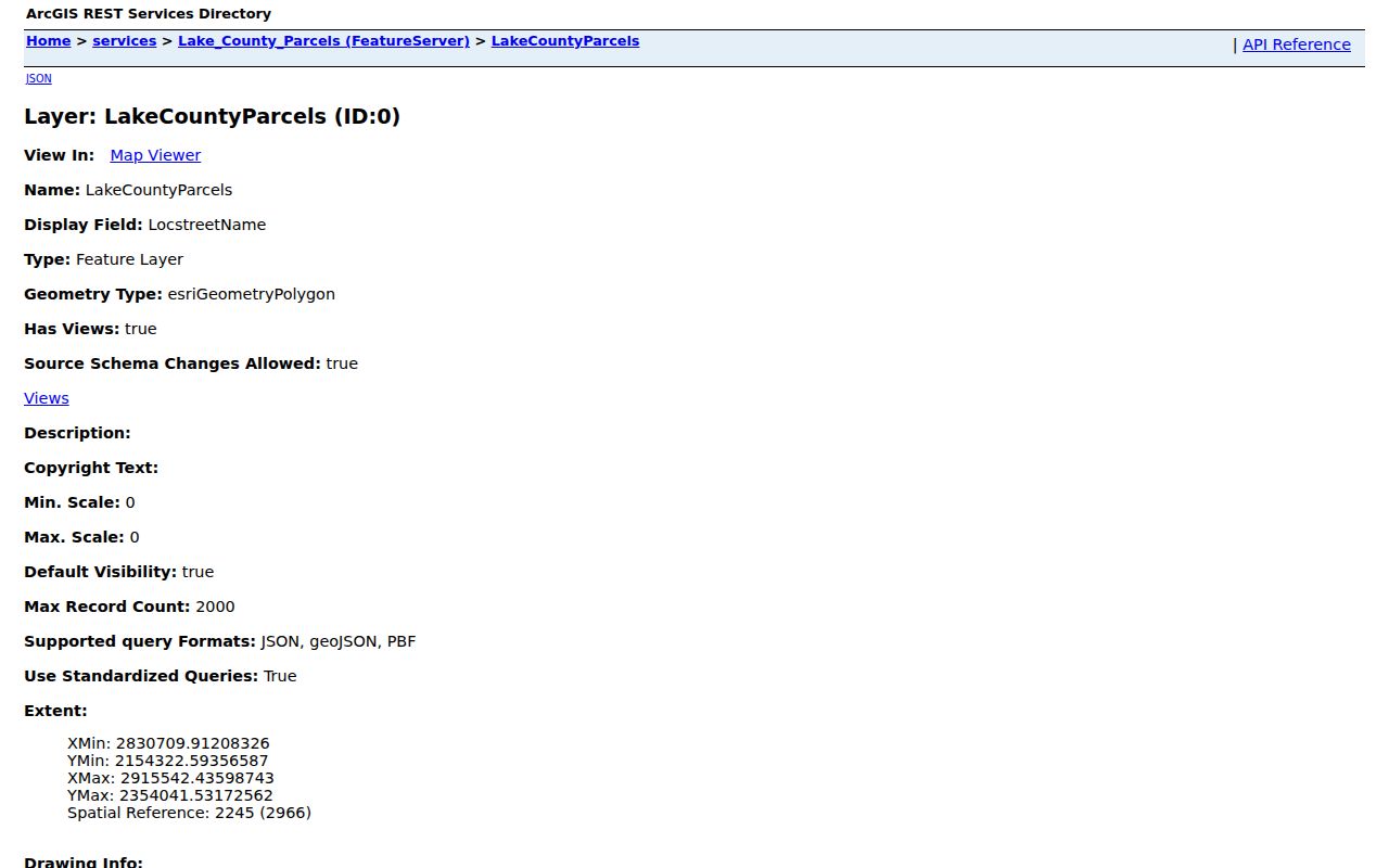
That field list explains why the parcel key works as the bridge between the map, assessor, tax, and Recorder routes.
Crown Point's own GIS program began collecting data in 2006 and now describes more than 470 current and historical layers. The city maps collection adds streets, districts, subdivisions, zoning, and flood or wetland context.
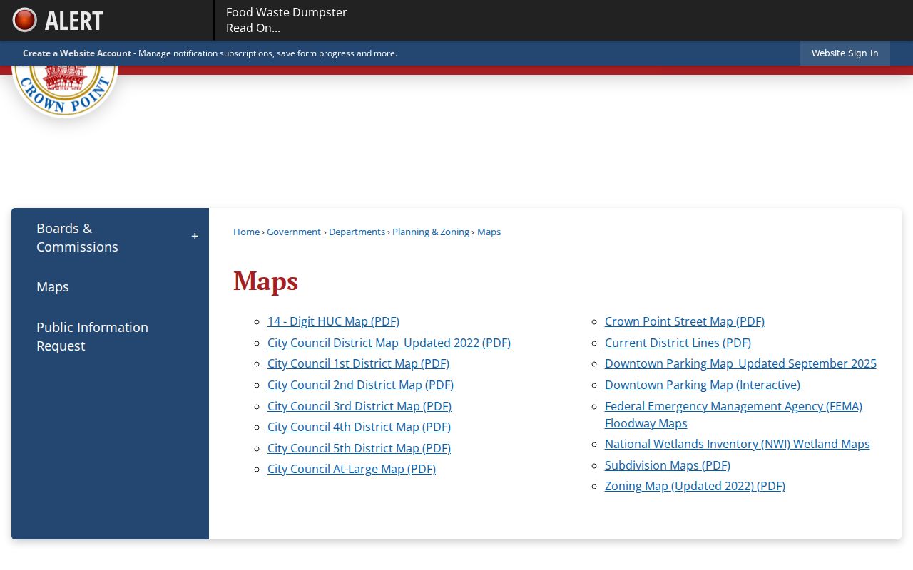
The city map page supplies jurisdiction and district context that a postal label alone cannot. Use the current municipal boundary instead of assuming every Crown Point mailing address lies inside city limits.
The downtown grid includes Main, Court, East, South, Indiana, Grant, and nearby named streets, while broader Crown Point maps add numbered avenues and later subdivisions. A postal Crown Point label can extend beyond the incorporated city. Compare the parcel's municipality and township fields before sending a permit or code request to a city office. If the land sits outside city jurisdiction, the county source may be the correct keeper.
Crown Point Deeds by Street
Transfer History on a parcel card is a lead, not the recorded instrument. The Lake County Recorder keeps deeds, mortgages, liens, releases, leases, subdivision plats, surveys, UCC filings, and related papers. Indiana law requires grantor and grantee indexes with recording information and a concise legal description. Search the current owner as grantee to locate a purchase, then search that deed's grantor as a grantee in an older record.
The Recorder document search redirects to an account screen before full fields and images appear.
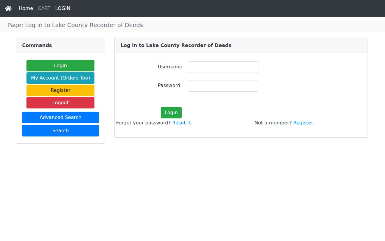
The gate is why a prepared request matters. Give the office the party role, date range, legal description, parcel number, document number, or book and page. The portal states that recordings exceed 200 years and include more than three million documents. Images cost $1 per page plus a $3 order charge. Confirm current payment rules before ordering.
Recorder instruments can also reveal more than a sale. Mortgages, releases, liens, leases, plats, and surveys may explain why a name stays tied to a Crown Point parcel after another source changes. Court orders, wills, marriage licenses, and birth or death certificates are generally kept elsewhere, so do not ask the Recorder for every record that happens to mention an address. Match the request to the office's own record series.
Crown Point Permits by Address
A parcel tells where land sits. A permit can date work done there. Crown Point's Building Department uses an account-based EnerGov route for applications, plans, contractors, inspections, and project status. Code Enforcement does not publish a live case index on its public page. Ask for a specific address, date range, permit or case number, and record type through the city's public-information route.
The Crown Point Building Department explains its permit and inspection channels.
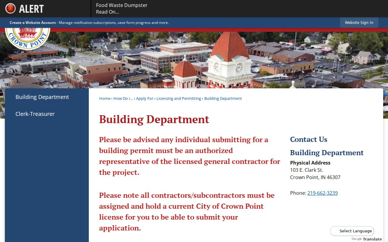
Permit names may identify an applicant, owner, or contractor, not every person at the address. Historic Preservation Commission applications and minutes can add an owner, architect, action, and date for properties within its scope.
Crown Point Streets in Print
The Crown Point Library's Indiana Room supplies the address-to-name layer that modern parcel systems lack. Haines criss-cross volumes cover 1982 to the present. Robinson directories are scattered from 1941 through 1996, and phone books run from 1975 to the present. Search the street section and alphabetical section separately, then compare the name with deeds and newspapers.
This street directory use is intentionally narrow. The collection years, publishers, and entry-reading method belong on the Crown Point city directory page. For address work, record the exact volume year, page, street spelling, unit, and notation. An occupant or phone subscriber may not be the parcel owner, and unlisted households will not appear.
The library also holds Sanborn sheets for 1886, 1892, and 1899, plat material, Lake County Star microfilm reaching from the 1850s, and an address-focused photo notebook. Those sources can help when a structure or street label predates the modern parcel card.
Search newspaper microfilm around a transfer or permit date for legal notices, business items, marriages, deaths, school news, and civic events. Record the issue and page because the run is described as almost every issue, not a complete run. A dated notice may explain why an address shifts between two printed volumes, but it should still be checked against the parcel and deed chain.
Request Crown Point Street Records
Online access is only one channel. Lake County offices at the Government Center handle assessor, Recorder, tax, GIS, and other records. The Assessor can be reached at 219-755-3100, the Recorder at 219-755-3730, and county GIS at 219-755-3752. City Engineering is 219-662-3242, Building is 219-662-3239, and the Indiana Room is 219-306-4593.
For a mail, email, counter, or Indiana Access to Public Records Act request, state the physical address, parcel number, record type, date range, and preferred format. Ask about fees before requesting a large file. The county Commission on Public Records routes the request but says copies come from the office that created the record. Recorder requests should add grantor, grantee, legal description, or book and page when known.
Note: A focused request with one address and date range is easier for a custodian to locate than a request for an entire street.
Crown Point Street Directory Limits
No Crown Point street directory source identifies every person in a home. Assessment and deed records focus on owners and land. Directories omit unlisted people and can be out of date. Utility customer lists, motor-vehicle addresses, private household members, and protected voter addresses are not ordinary public directory fields. Indiana's Safe at Home and protected-voter rules may suppress information for eligible people.
Commercial compilations can blend stale names, parcels, and phone data without showing when a fact changed. Treat the official custodian's dated record as the source for its limited purpose, then verify across a second source. Never publish more personal data than a lawful research task needs.
Lawful use. Crown Point address records are for lawful personal research, property history, and civic review. Never use them to stalk, harass, threaten, or harm anyone.